In the fall of 2007, Eric Kujala and I explored the lakes within the Brent Crater by canoe to get a first hand appreciation of it’s size.
This is my “crater exploration partner”, Eric Kujala. Here we are exploring the Presqu’ille Impact Crater.
First we had to lug the canoe down into the crater! The portage down to the crater bottom from the road is not trivial; it is a physically demanding exercise. But, the trip through the lakes is well worth the effort.
Shortly after the initial impactor contact here 396 million years ago, the crater was covered and protected by a post impact sedimentary rock layer. This had the effect of “preserving” the crater’s form. Usually a crater of this age on earth would have had substantial geological erosion and would not have conserved its “crater shape”. The remnant of the Presqu’ile impact structure is an example of the magnitude of erosion occurring without protection over a similar length of time.
Lake Tecumseh within the Brent crater. The north Brent Crater rim is illustrated in the centre background of this image.
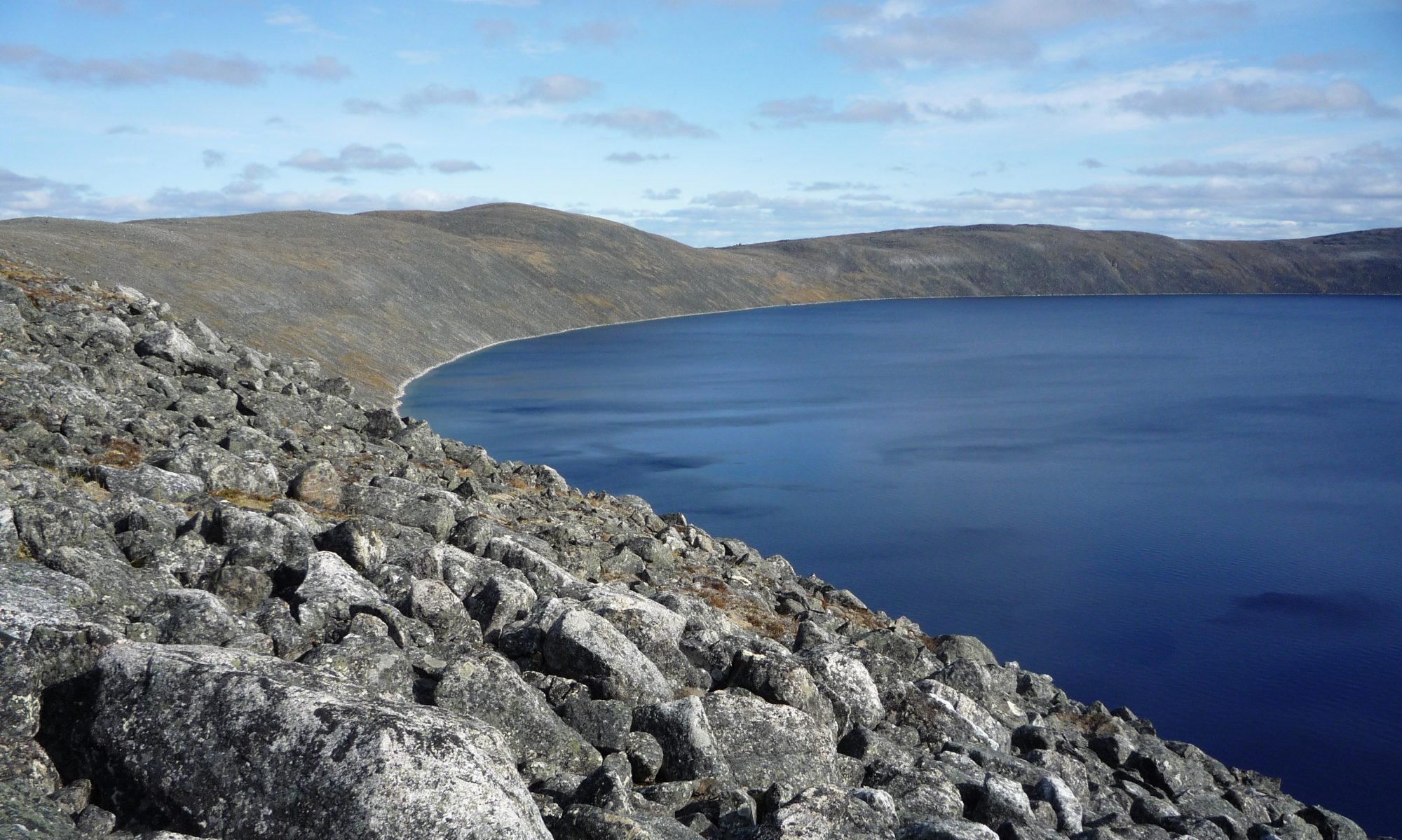
It is hard to imagine a 1 km thick layer of ice flowing over this rim heading south. About 10,000 years ago the protective sedimentary layer over the impact crater was finally eroded away by these glaciers. In the left (west) of this image is the glacial till deposit in the bottom centre of the crater. Under this till is a 200 Metre thick layer of sedimentary rock layer. This is a remnant of the sedimentary layer that “protected” the crater and was in turn protected from glacial erosion by the crater’s bowl shape.
North shore of Gilmour Lake looking west within the Brent crater.
The north shore of Gilmour Lake, illustrated here, is directly adjacent to the north rim of the crater. The Brent Crater rim is covered by a substantial layer of glacial till making it almost impossible to find any bedrock (and maybe in situ breccia). The bush in this area was described to me by a forest ranger as a “tree slum”. The dead brush between the trees makes this area almost impassable for exploration.
East shore of Gilmour Lake looking south within the Brent crater. The south rim of the crater is visible in the distance. This image gives you a true appreciation of the size of this impact crater.
My previous ground exploration trips to the crater resulted in unsuccessful searches for the “elusive” impact breccia. On this trip we did we find, IMPACT BRECCIA!! Finally!!
Brent crater impact breccia.
We were very fortunate to spot these breccia examples. They WERE NOT found as in situ deposits but were most probably placed here by the glaciers (glacial erratics). So, scientifically, without material analysis we cannot absolutely claim that this is breccia from the Brent Crater impact, BUT, the circumstantial evidence is almost conclusive. The other explanation is that these deposits were from another impact site further to the north and just “happened” to be dropped off here within the Brent Crater.
Brent crater impact breccia.
The impact melt is visible here as the “greyish” material between and cementing the country rock fragments. K-Ar dating of the recrystallized melt-bearing breccia gave ages of 310-365 Ma (Shafiquallah et al., 1968), since updated by K-Ar studies on the coarsely crystalline melt rocks using post 1977 decay constants. Pre-1977 K-Ar, Ar-Ar and Rb-Sr ages recalculated using the decay constants of Steiger and Jager (1977) Ages in millions of years (Ma) before present. Geochemical analyses show that the “melt” rocks are in fact melted target rock with ~1% contamination by chondritic material.